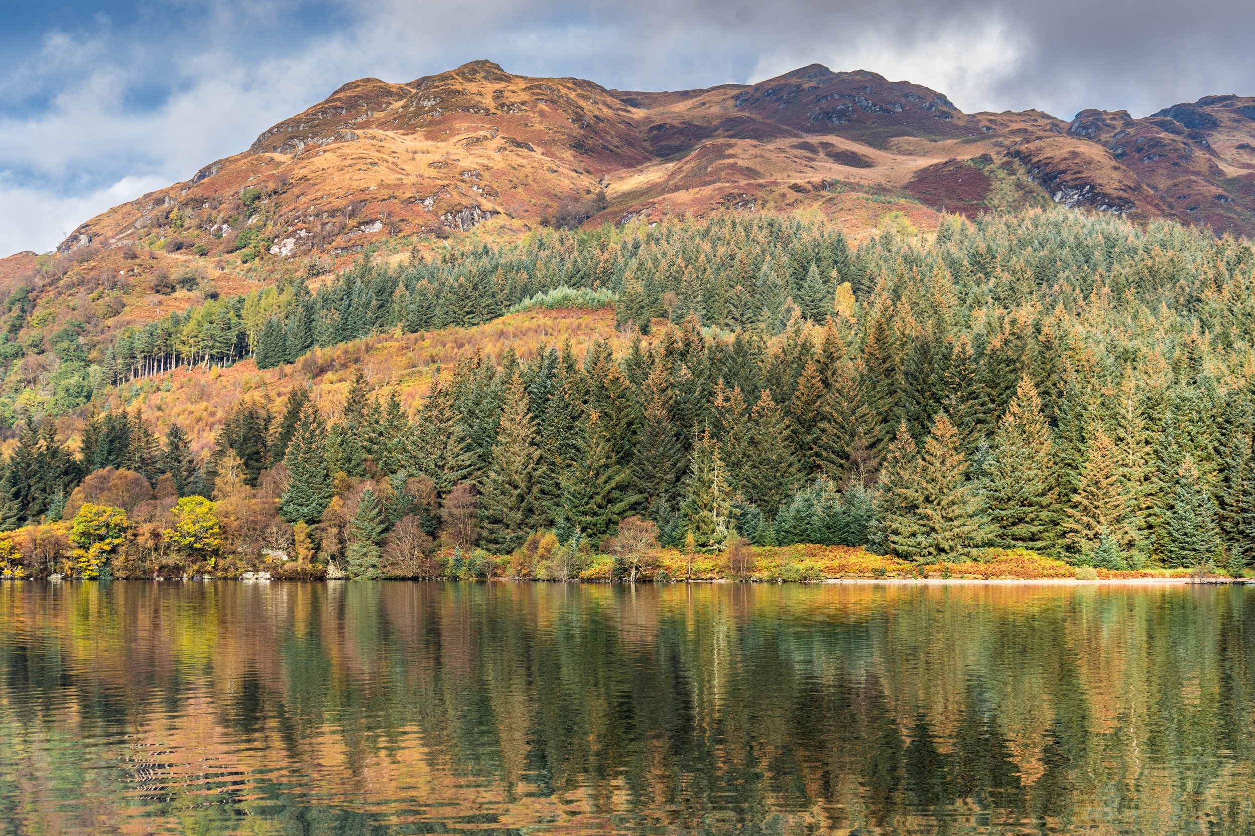
Loch Katrine History
The Birthplace of Scottish Tourism
At the turn of the 18th century, when literary giants such as Sir Walter Scott, the Wordsworths and Coleridge ventured on some of their epic journeys to discover ‘the raw beauty of Scotland’s scenery’, they sheltered in what was described as ‘rudimentary huts with bracken roofs at the eastern end of Loch Katrine’, and their writings subsequently led to Scotland’s first tourism boom.
A couple of huts were provided by Lady Drummond of Perth, the local landowner, who was concerned with ensuring there were shelters for these early travellers drawn by the sheer beauty of Loch Katrine.
Access to the Rhoderick Dhu viewpoint that inspired Sir Walter Scott to write ‘The Lady of the Lake’ was blasted out of rock at the end of the 1700s.
Discover the rich history of Loch Katrine, linked strongly to its dramatic landscapes.
Today, legends of Loch Katrine are told by our captains on all the regular cruises; we have also carried on with work started by Lady Drummond, allowing visitors to stay in high-quality lodges to enjoy the beauty of Loch Katrine.

Sir Walter Scott
Sir Walter Scott’s Poem, The Lady of the Lake
In 1810, Sir Walter Scott, one of Scotland's most celebrated literary giants, published his poem, 'The Lady of the Lake', set at Loch Katrine. Scott was inspired by the magnificent panoramic view of Loch Katrine from Roderick Dhu Footpath. Below, you can listen to an audio story about Sir Walter Scott’s adventures in Loch Katrine.
Scott’s poem was a best-selling blockbuster, and his vivid descriptions of the landscapes drew large crowds to see them for themselves. This was the beginning of a boom in tourism for the nation, which is why Loch Katrine is rightly considered the Birthplace of Scottish tourism.
Rowing boats provided trips to meet visitors' demands in the 1800s. Later, the eight-oared wooden galley Water Witch was introduced, taking eager visitors to Jonathon's Isle to sample what was described as goat's milk but was whisky!
Loch Katrine’s First Steamer
Loch Katrine's first Steamship, the Gipsy, was launched in 1843. However, she sank under mysterious circumstances just a week after her arrival, with the suspicion that the ferrymen of Water Witch had scuppered her, having not been given jobs on the new steamer. The Gipsy remains at the bottom of the deep water in the loch.
Despite the sinking of the Gipsy, steamships would soon become popular permanent features on Loch Katrine. The coming golden age of steam would revolutionise the Victorian era and lead to mass tourism in the Trossachs.

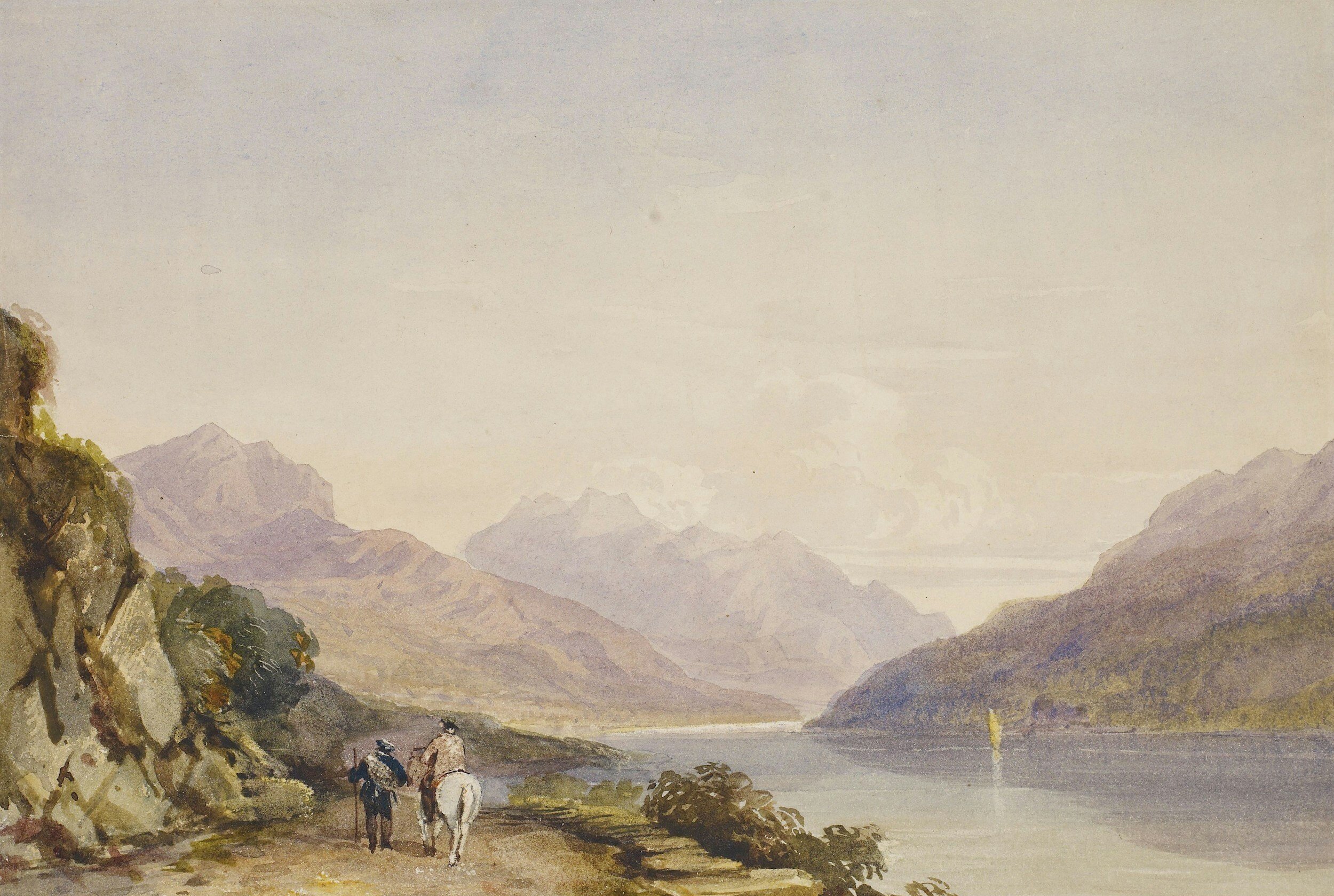
Victorian Artist at Loch Katrine
Landscape with Tourists at Loch Katrine by John Knox was painted around 1815, capturing the vivid landscapes described in ‘The Lady of the Lake’, where visitors waiting to board a ferry are greeted by a piper. The picture hangs in the National Galleries of Scotland.


Rob Roy Steamer
Rob Roy MacGregor
Sir Walter Scott was attracted to Loch Katrine by the beautiful landscapes and the stories of of clan chief and outlaw Rob Roy MacGregor, born at Glengyle at the far end of the loch in. Scott would write a novel about Rob Roy, helping to romanticise him to legendary status, with two Loch Katrine Steamships named after him.
Rob Roy Steamers
The first Rob Roy Steamer was built in 1845 by the William Denny & Bros of Dumbarton on the River Clyde The 70ft Iron Paddle Steamer began sailing in July of that year and continued service until 1855. In 1855 she was sold to contractors working on raising the loch level as part of the work to construct the new waterworks.
Rob Roy II was commissioned in 1855, again at Denny's, for the cost of £2,350, but this time on behalf of the newly formed Loch Katrine Steamboat Company. Launched in 1856 and was in service for 44 years until 1900 under the stewardship of Captain J. Munro.
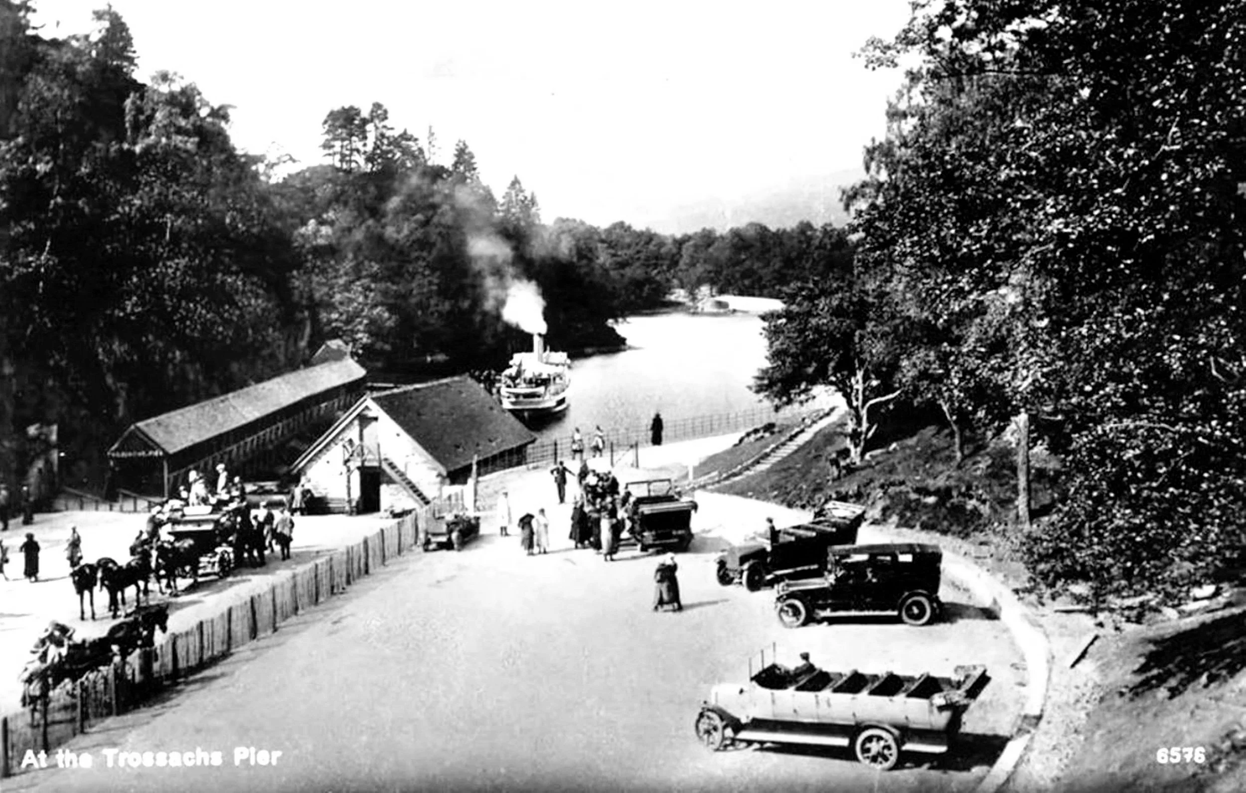
Golden Age of Steam
The Golden Age of Steam brought visitors in new forms of transport, with char-a-ban (an early bus) replacing horse and cart. The railway arrived at nearby Callander in 1858 and Aberfoyle in 1882.
These advancements in travel resulted in the much-celebrated Trossachs Tour, with holidays exploring the Scottish Highlands by road and steamship travelling across Loch Katrine and onto Loch Lomond.


Queen Victoria sails on Loch Katrine
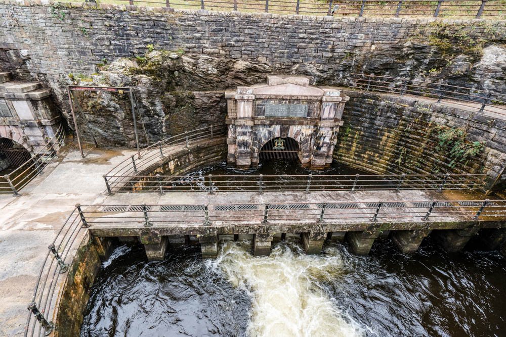
Queen Victoria and Prince Albert sailed on Rob Roy II in October 1859 to the major new waterworks on the lochside, which supply millions of gallons of fresh water to Glasgow daily. Nearly a decade later, in September 1869, Queen Victoria visited Loch Katrine twice more, sailing again on Rob Roy II. This led to her writing in her diaries about how she was captivated by seeing the locations described in 'The Lady of Lake’.
Listen to an audio story about Queen Victoria’s first visit and more about the positive transformational effect the supply of clean water from Loch Katrine had on Scotland’s largest city.

Steamship Sir Walter Scott
By the end of the 19th century, Rob Roy II was drawing to the close of its working life. The Loch Katrine Steamboat Company commissioned William Denny & Brothers of Dumbarton on 20th February 1899 to build Steamship Sir Walter Scott for £4,269.
Denny's quickly built the new Steamship, which launched on 31 October 1899. Unfortunately, they were to lose money on the project due to the difficulties and rising costs of transporting the new ship to the landlocked loch.
Transportation to Loch Katrine
In sections, the boat journeyed by barge up the River Leven onto Loch Lomond, where at Inversnaid, horse-drawn wagons lugged them to Stronachlachar for reassembly.
The New Steamship
After a short overlap during the 1900 season, S.S. Sir Walter Scott replaced S.S. Rob Roy II, which went into semi-retirement, occasionally carrying cargo until 1911, when she was broken up and sold.
Captain MacKinnon
Passengers flocked to sail on the new Steamship captained by John McKinnon (pictured).
Listen to an audio recreation of the early days of the Steamer and discover the impact that the first captain’s family had on the first 60 years of the Steamship.

Steamship Sir Walter Scott Timeline - 1899 to present day
-

1899
Steamship Sir Walter Scott is built at William Denny & Bros in Dumbarton.
-

1900
Sir Walter Scott Steamship goes into service, replacing Rob Roy II (Both are pictured here)
-

1939
The Steamer is hidden away during World War II for fear of her being bombed
-

1991
New boilers are installed, part of major repairs to the Steamship.
-

2000
Robbie Coltrane presents a TV documentary to mark the steamships 100th anniversary
-

2005
A charitable trust is set up to preserve the Steamship for the nation
-

2007
New, more efficient bio-fuel boilers are installed.
-

2009
A new lounge is added to the foredeck
-

2019
The Steamer helps commemorate 160 years of the Loch Katrine waterworks.
-
2021
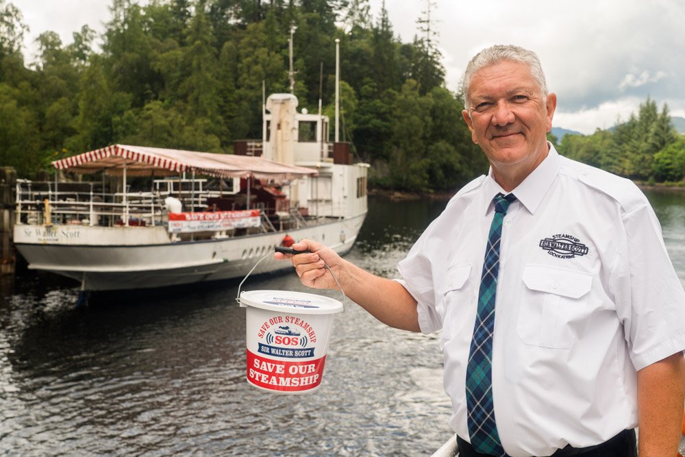
An SOS - Save our Steamship appeal is launched to raise funds for urgent repairs.
-
2022
Replacement boilers are winched into the engine room.
-

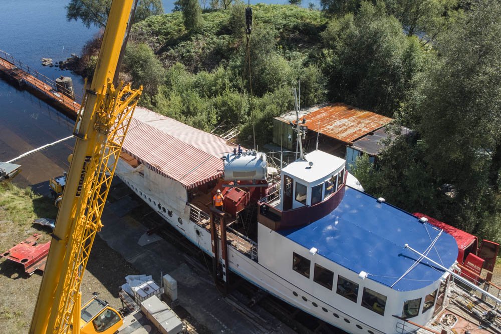
2023
Following a £850,000 restoration this is the steamer’s first passsenger cruise.
-

2024
A new scneic tower opens where Sir Walter Scott was insipred to write The Lady of the Lake.
-

2025
Steamship Sir Walter Scott is awarded Flagship of the Year 2025 by National Historic Ships UK.

180 years of Steamships at Loch Katrine
Enjoy the new exhibition on the covered pier approach with the story of Steamships at Loch Katrine. Morag Jeffrey, a descendant of Steamship Sir Walter Scott’s first two captains, opened the exhibition. Morag is pictured here with Loch Katrine’s Managing Director Gordon Allan.